Saturday, May 8, 2010


Day 48

Dauphin Island, Al. to Big Lagoon State park, Fl.

Got an early start this morning packed up camp with Gerry and Ron, and headed to the fort. The fort is Fort Gaines – site of Battle of Mobile Bay. This is the battle where Admiral Farragut, aboard his Flagship U.S.S. Hartford, uttered the now famous words “Damn the Torpedoes-Full Speed Ahead!” The fort is pretty amazing to walk around, it is completely open and you can explore virtually every inch of the area. It is a $5.00 fee to get in which we were told is barely enough to keep it open. It is well preserved and has many of the big guns still in place at the corners. The museum had some interesting artifacts found on site and a lot of history as well as good examples of daily life in the fort.

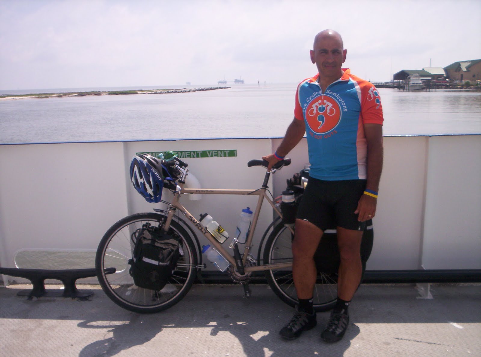
It was now 10:30am, we were only riding a short distance today (about 50 miles), and so we were in no great hurry, but the ferry to Fort Morgan had arrived so we needed to go - or wait an hour and a half for the next one. We headed for the ferry and could not help but notice the presence of the news media; they were there to keep track of the impending landfall of the oil spill from the collapsed oil rig in the gulf. They were not interested in us or our rides; they were busy with the “big story”. We boarded the ferry and enjoyed the ride and the awesome views we were afforded on our way.

As we were docking in Fort Morgan, we could not help but notice about a hundred people putting together containment booms, and boat after boat going out with 500 ft. sections to be anchored off shore to help protect the island. We rode down the street a little ways and decided to look for something to eat, we found a place called “Tacky Jack’s”, we decided it sounded just like us so we went in. It was a nice place and were welcomed and told the story of how this building is the only original building left in the area, it had survived all the previous storms that nothing else did.

The food was very good and the service was even better, we were wished well by the staff and were once again on the road. We still had most of our day ahead of us so we picked up the pace a bit to Make it to Big Lagoon State Park. We stopped along the way to check out the beautiful white sand beaches, and see what kind of indigenous life there was in the area (bikini watching).

The weather was warm and very humid, and it was tempting to jump in the water, but it was so far to walk over the sand and we would eventually have to get back on the bike – not fun when you are soaking wet! We continued on and before long found ourselves at a “Welcome to Florida” sigh. We stopped and spent several minutes talking about how we had finally made it our last state, and how it was starting to sink in that we were almost done. After several pictures we started off again, it was only 10 miles or so till we arrived at the state park. As we rode on we passed a fire station, the guys know I like to stop and headed right in. We talked to the firefighters on duty, they would try and send me a patch – but more importantly they told us where to go for dinner. We left and arrived at the Big Lagoon State Park within minutes, and immediately set up camp, showered and were ready to go get dinner.

Dinner tonight was at Trigger’s, a nice family restaurant, a little high priced but very good food. We sat and ordered dinner and toasted ourselves for the accomplishments we have made. After dinner I decided to have dessert, the list was long and the decision difficult – but in the end I went for the fried cheesecake. It was a piece of cheesecake rolled in corn flake, deep-fried, then covered with a hot caramel and pecan sauce. It was amazingly good! If you have the chance, go and try it!

The Garmin information for the day is as follows:

Day 48 Dauphin Island, Al. to Big Lagoon State Park, Fl. by wegotguts at Garmin Connect - Details


Day 47

Slidell, La. to Dauphin Island, Al

Today as I woke up I decided to change my endpoint for the day. I skipped ahead to the next waypoint of Dauphin Island. It was a 100 mile day, but I was ready to do a century ride. Wit Tammy helping ( I think she makes an awesome logistics coordinator) we decided that the best way would be down Highway 90, the Google map pictures showed a decent highway with shoulders. I set out from Slidell since I arrived late and did not have exact change for the overnight drop.

I went in and paid after I broke down camp for the night. I remembered a Waffle House down the street, so I headed out for breakfast. Hitting the road at 9:30am it was already 82 degrees. I took the necessary roads to get me to highway 90, and was on my way. The roads were nice and not much traffic to speak of; the wins were light and variable, so no problems there either. I was doing very well time wise and had no doubts I would make Dauphin Island by nightfall. I passed several nice communities and crossed many rivers, marshes, and swamps before coming to Bay St. Louis. There is a nice bridge with awesome views looking out to The Gulf of Mexico.

After crossing the bridge I started to ride along the Gulf of Mexico beaches, they are beautiful white sand beaches, and nice parking spots all along the roads for the public. There is a worried air about the people with the threat of the oil spill hitting their beaches. The house along this stretch of road are quite beautiful, and some houses were noticeably absent or in the process of being rebuilt. There were many areas of the beaches that are set aside for nesting Least Terns, so as you walk or drive by, they fly off and then return, and there are hundreds of them.

I rode through Biloxi, Mississippi, and saw the Hard Rock Hotel and casino, and the Beau Rivage casino. After Biloxi I went through Ocean Springs, Ms. and found a firehouse on main street, so I stopped for a patch. The Battalion Chief was not able to find one quickly so he said he would send one off to me when he finds them. I left a patch for their patch collection and was again on my way. Next up Pascagoula, and Grumman ship building, you could see the facilities from the highway, and it looked quite expansive. By now I was hitting rush hour traffic and people were driving much more erratically, so

I was glad to see the highway starting to go back to a little more of a rural highway. The traffic eased as rush hour waned, and before long I came across the welcome to Alabama sign. Wow two states in one day, I felt reenergized as I began to doubt I would make my destination. Now that I was in Alabama I only had two roads to follow – Rt 188 to Rt 193 straight to the campground, but the sun was getting low in the sky. As I rode through the last few towns before Dauphin Island, the sun had started to disappear behind the trees, and then I finally got to the Dauphin Island town limit – it is at the start of a long and tall bridge I must cross to get on the actual Island. As I started to cross the bridge, the sun had almost completely gone down and had left beautiful hues of red, orange, and purple in the sky. I still had another 6-8 miles to go and darkness was upon me, I had my taillight flasher on and my headlight (not a true headlight-but it worked) on and finally crossed onto Dauphin Island, after getting all the way to the East end of the Island, I found the campground just about to close for the night.

I went in and got a spot for the night and some food for dinner. The woman behind the desk put me next to two other sites with bicyclists on them, cool I could exchange stories in the morning. When I walked to my campsite, I could not help but think the tents next to me looked familiar…. I called out “Gerry?-Ron?” and they both answered. I just commented that they could run but they can’t hide! They came out of their tents and helped me set up mine, while we exchanged some stories of the past few days since we parted ways. The mosquitoes were quite bad, so they went back to their tents, after telling me how nice the showers were. I finished setting up and went for a shower and quickly went to bed – it was after all 9:30 at night!! A LONG day, it ended up being 125.69 miles total for the day, and now for some well deserved sleep.

The Garmin information for today is as follows:

Day 47 Slidell, La. to Dauphin Island, Al. by wegotguts at Garmin Connect - Details


Day 46

New Orleans to Slidell, La.

I have enjoyed my second night in a hotel. I was buried in pillows with the A/C on high and snuggled comfortably into the bed; I had a nice hot breakfast and a nice tub to soak in. I was desperately trying to enjoy as many conveniences as I could before I start the home stretch to St. Augustine!

I started a little later that I wanted (by about 2 ½ hours), but it was a beautiful day and I had not far to go (Slidell is about 50 miles). By the time I got to the Gretna ferry, I was for the second day in a row -late- I had to go to Algiers to get to Canal St. an extra 6.5 miles. Today it took an unusually long wait until we were able to cross. When we made the crossing over the Mississippi for the final time, I was ready to take a SLOW day and check out New Orleans. Tammy was on the phone with me as I walked the bike off the ferry and through the street of New Orleans, I was thirsty and she found there was an Arby’s just blocks from me (the internet can be so fun), so I decided to eat lunch now then do some exploring.

The Arby’s was two floors of seating and quite different than I am used to seeing, I finished lunch and checked out the little shop next door. It had lots of beads in all assortments from a “G” rating to almost an “X” rating, who knew they made beads like that too! I started to walk around the streets again and was enjoying the street cars driving by and people watching. There are truly many different lifestyles and looks represented on the streets of New Orleans, and was fun to watch!
Tammy called again to see where I was and told me to trust her when I gave my location. She told me to go 3 more blocks and take a right – which I did – and found myself on Bourbon St. What a sight, it was daylight and you could still see all the neon and reflective signs all the way down the street. There were people everywhere and the activity was somewhat frantic with people in and out of shops and bars. I went to Jesters and bought myself a souvenir plastic Jester full of a frozen something-or-other, that was incredibly good, and STRONG!! After drinking this magic concoction I decided I needed to get going, so I found an empty spot in a front bag on the bike a left the very long straw sticking out to finish as I walk.

Drink finished, and time to head towards Slidell, it was nearly 3:30, and I still had 25 or so miles to go. I headed out on the pre-prescribed route, and before long found myself on the side of Lake Ponchatrain , and was trying to closely follow these shores. This did not work, before long I ran right into a construction project and had to divert to a new route – out to Rt. 90 and over the Highway 11 bridge to Slidell. The bridge here is only 5 miles long instead of the 12 mile bridge on I-10, and much less traffic. I was able to make good time over the bridge which was a relief since there is no shoulder on the bridge for bikes to ride in. Before I finally left New Orleans, I came across a fire station, and was able to trade patches, to help add to the growing collection.

Arriving in Slidell, I was looking forward to a nice shower and some rest. I rode right past the campground I was to stay at on the wrong road and ended up in front of Textron, makers of tanks and armored personnel carriers. When I finally figured where I went wrong I headed down the right street and got a spot at the campground. The campground was closed for the evening when I arrived, so I had no codes to use the bath/shower and no internet access. After checking the 3 sites listed at the office for help, and finding no one at all 3, I stopped at a campsite and asked the people there if they knew the codes, they did not. After making some phone calls to no avail, they finally insisted on me showering in their Trailer. After a few moments I reluctantly agreed and finally was able to shower and freshen up.

Pam & Hollis Davis were the names of the people who were so kind to me. We sat and talked about how they lost their home in hurricane Katrina, and have been living in their fifth wheel trailer in the campground (it is a beautiful trailer and the site is very well decorated). They offered me a burger for dinner, and then said they were cooking steak, when all was said and done they did not have the steak they offered, so Pam took it upon herself to order take out at Outback Steakhouse two exits down the highway. She came back with a dinner for me consisting of Filet Mignon (feta cheese encrusted), shrimp, and salad. Pam placed all of this on nice plates and a tray, and had a home-made piece of carrot cake from a friend for dessert.

I want to say a HUGE thank you to both Pam and Hollis for their kindness; it was far above anything they needed to do. They owed me nothing and showed me one of the greatest kindnesses of the trip – for this I am forever grateful. Thank you both and maybe our paths will cross again. Thank you – Thank you – Thank you!

The Garmin information for today is as follows:


Day 46 New Orleans to Slidell, La. by wegotguts at Garmin Connect - Details


photo blogging tonight


I am going to just do some random pictures over the last couple of days.

Just kinda a picture book. I do have blogs from the last couple of days but I need to get out and walk and stretch my body. I have been sitting way to long. I will try to keep things up to date as I can this week. I have had little to no internet over the last couple of days but I am excited to post the end date for the ride and plans that have been made.

Thank you to all who have supported this awesome adventure. It has really been a great time and I look forward to getting all the pics together and finding a way to share them. But for know enjoy some from over the last few previous days!!!!

End of the ride

The end of the ride is near and will be on May 14th in St. Augustine Florida. For anyone planning to come out to celebrate with me or better yet ride with me (PLEASE DO) the following arrangements have been made.

I will arrive at the covered pavilion area at 124 Charlotte St. off of King Street and the official end of the adventure cycling maps at 3:00 pm on Friday, May 14th.
I would love to have a group of people to ride and run with me to the water for the ceremonial tire dipping and celebration of the end of my ride that will take place at Anastasia State Recreational Park. The following arrangements have been made to join me.

We will leave the covered area at 3:30 pm and travel 3.7 miles to the parking lot and south portion of Anastasia State Recreation Facility. For parking arrangements you can either, park at the State Park from where we will be ending and ride to meet at the covered area on Charlotte St. or there was limited street side parking in the area.

I have included the link to a map of the area and the route we will ride to Anastasia State Recreational Park.

http://www.mapmyride.com/view_route?r=404127333779396181

Sunday, May 2, 2010


Day 44

Laplace to New Orleans (Harvey)

I started today from the fire station in Laplace (station 3). The guys came out to let me know they had left coffee and mugs on the counter. To all you guys whom I never got to meet-- A BIG THANK YOU!

When I finished my coffee and folded my tent I was ready to hit the road, but a thunderstorm hit. I waited under the front porch until it eased a little. I started off and was met by another wave of heaver rain. I managed to get some shelter at a Shell stsation for a little while. When I started down the road again I found my self ducking for cover every few miles for the first hour or so. I came across a McDonald's, and stopped for coffee(to warm back up) and some breakfast.

This time when I hit the road I never had much more than a quick rain shower to slow me, the wind was in my face all day but manageable. I rode until I ran out of road - then I got to take a break on the ferry across the Mississippi. Once on the otherside I was only 6 or so miles from my hotel. When I Arrived the woman at the desk was very kind, and was able to get my room ready early. I was finally able to get some well deserved relaxation, and a good warm bath. Off to bed for some rest, then off to the convention center tomorrow!

Todays Garmin information is as follows:

Day 44 Laplace to New Orleans by wegotguts at Garmin Connect - Details


Day 43

New Roads to Revere

Today will be a difficult day and at the same time a very exciting day. When I leave the campground, I will be leaving the last of my new friends to go on the route with my own time schedule, and destinations.

We all got up early today, to figure our schedules and try to make sure we beat the rain that has been threating us the past two days. We watched the ducks, and their ducklings swimming around the edge of our sites, while we drank coffee and discussed plans. Karman and I will leave this morning together, and split so that he may rejoin Emilio in Baton Rouge. Ron and Gerry are heading off together, as they share a similar time schedule to Florida(around May 19th), by way of the regular Adventure Cycling route.

We packed our sites and took some final pictures and were off, my objective for the day - Revere, La. - to meet a fellow colon clubber at a relay for life there. The survivor lap is at 6:00 pm, should be no problem with our early start!

Karman and I headed for the ferry in St. Francisville, this was kind of the long way around, but we heard the town is quite beautiful so we decided to go through it. We caught the ferry(being on a bike we went to the front of the line and made the next ferry)and crossed the mighty Mississippi. When we got to the other side we were met with a couple of hills, we have not had many of those so it just felt weird. The architecture was instantly like that in the history books, columns, and southern influenced buildings.

We headed down Rt 61 and dodged all but the smallest of a mist for rain, the roads were wet and we were not, this was a good sign for the day. Karman got to his turnoff and said good-bye with hopes of seeing each other possibly in New Orleans.

I was off to revere, I still had some 45 to 50 miles to go to get there, to make 6pm. The wind was in my face all day; at times so much so, it was like someone was pushing on my chest to stop me. When I thought I was getting fairly close I turned the garmin directions on and folowed it to what I thought was going to be the RElay for Life. Boy was I wrong, the Garmin took me to Gramercy, and was leading me to a sugar plant - I don't think thats right. I got directions and headed further down Rt 61 ( I was told 5-7 miles), but now it was 5:35, and I had to fight a headwind to get there.

I pulled into the stadium as they were just finishing the last speech and looked for Darcey. The registration table was very helpful and when they found I was a survivor they set me up with a shirt, and my tickets for the survivor dinner. I parked the bike donned my shirt, and Darcey showed up and introduced herself. We walked the survivors lap and exchanged stories and got to know each other a bit.

I was introduced to her family, at their booth - They were "The Tough Cookies" - "Eliminating cancer one bite at a time". They were selling fried oreos (and a bunch of homemade cookies as well)- I finally got to try them and I am entirely hooked on them. I will be making them when I come home - so stop by a try some!! We walked and talked and I was introduced to many survivors that Darcey knew, they all had such unique and inspiring stories, Then it was time for the luminaria ceremony - they used purple glow sticks in the white American Cancer Society bags - tehy stopped the walkers and shut the stadium lights one by one, and lit the word HOPE on the bleachers for all to see.

The speech was beautiful, then they played a few songs --- "I Can Only Imagine" - by MercyMe, "Save a Place for me" - by Matthew West, then Came "Amazing Grace" - by LeAnne Rymes, "Cryin for me" - by Tobey Keith, and ended with "The climb" - by Miley Cirus. By then there was not a dry eye to be found.

After the lights were turned back on we went back to walking and enjoying the people there. The winds stayed srotng and the severe threat of weather brought an early end to the night. I helped Darcey and her family pack and they were kind enough to drive me and my bike around to find a motel in the next town(it was midnight now).

All the hotels were full so we stopped at the local fire station (Laplace Station 3)where the on duty staff said it would be ok to pitch my tent in the yard for the night. I said goodbye and went to setting up for the night. The predicted rains never came(thankfully), I stayed dry and was able to put my tent away dry the next
day!

Todays Garmin information is as follows:

Day 43 New Roads to Reserve by wegotguts at Garmin Connect - Details


Day 42
Simmesport to New Roads

To start today we had to cross the Atchafalaya River, it was a pretty good size hill leading to the top of the bridge, one we have not seen in a while! The roads were extremely rural with very little traffic. The farm lands are getting bigger and bigger as we travel. Corn seems to be the predominant crop now (as compared to crawfish and rice). We found several old churches along the road that each had its own cemetery. We were approached by a farmer when we stopped (he wanted to make sure we were ok), and so we asked about the churches, and found that most of them date 50-75 years back when the plantation system was in place and that most people did not move very far from their homes back then. This is why they each had their own graveyard and were not far from homes.

It did not take but a mile or two of riding today to start seeing the levee system around the area, we followed levees all day on the roads. The farmer we talked to pointed out a spot where we can cross the top of the levee and get right up to the shores of the Mississippi River (legally at a ferry stop), so we headed out and did just that. We found the road and went to the shores of the Mississippi for some pictures. Our first encounter with the river and it is running high and strong.
After passing this area we were riding along a flood control area that was quite well flooded, and very impressive with amount of water that was contained there. After following several more miles of rural farm road s in the head winds, we were finally in New Roads, La.

We were now trying to find Jim’s bar and grill, and campground. It took a while but we finally arrived to find a very nice area on the false river. We actually had campsites right on the waterfront, it was a nice setup for camping, we had food on site, and local entertainment in the bar (I will leave it at that!) We set up camp, showered, did some laundry and finally were able to sit and eat.

After dinner we sat and talked, as this is the last night I will be with Jerry and Ron. Karman and I will head towards Baton Rouge tomorrow while Jerry and Ron head out on the Adventure Cycling route. Emilio went to Baton Rouge tonight, as he is looking to get his spokes replaced (3 of them broke) and true the wheel up again. He and Karman are going to try to meet up with me in New Orleans; I hope we can make this happen as that will be the last I get to see of either of them. I will be Leaving New Orleans on May 4th and riding 11 straight days to finish the ride on May 14th, while they are planning on finishing on May 17th or so. Right now it seems that Ron and Jerry are planning on finishing in that same basic time frame.

I would have really enjoyed finishing the ride with my new friends, but this is not to be as I have a mission of finishing this ride for Crohn’s, colitis, colorectal cancer, and ostomies. I wish them all luck and safe riding and hope that I will be blessed with more friends, experiences, and stories as I continue…..

Today’s Garmin information is as follows:

Day 42 Simmesport to New Roads by wegotguts at Garmin Connect - Details


Day 41
Washington to Simmesport

Leaving Washington, we stopped for breakfast at the local Citgo gas station, and it was better than you can ever imagine. Eggs, toast, hash browns, and bacon, all cooked like a gourmet restaurant. We were on our way again! This day we were off to Simmesport, La.

Before we started on the road we stopped at an old church by the water tower for a couple of pictures. On the way out of town we ran across an old school house or church that just yelled photo opportunity. Leaving town we were riding 5 strong now, as Jerry from New Hampshire was now riding with us as well.

The roads are starting to get more winding and tree lined, so now we are encountering shade that we have not had since we were in California. The crops are all growing very well now, we see a lot of corn starting, wheat, and hay. I think the biggest change we have seen today is the water and swap area is definitely getting more frequent. The trees are starting to look like they should be in a swamp; I think they are Cypress trees. The trees are so different to us that we decided to get off our bikes and take some pictures by an area that had some particularly large trees, in a fairly small area.

Today’s destination is Maddie’s truck stop, it is not on the new maps but was well received on many blog posts. They are very bike friendly and offer free showers to all the bicyclists. As we were about 15 miles out of Simmesport we stopped for a quick snack and were talking to the owners who informed us of some bad news – the truck stop we were heading to had burned down two days ago! We were in a state of disbelief, what were we to do. We did have a plan “B” – the city park in Simmesport. We got on the phone to make sure this would be ok at this late time, and the supervisor of the park said he would leave the bathrooms open, and the water on. The only major drawback was that we had no showers, we were reduced to the old washup with a facecloth in cold water routine.

When we arrived in Simmesport we set up camp in an extremely windy park, and set off to find dinner. We had seen a diner on the way to the park (next to Maddie’s), so we headed out to see what they had to offer. Unfortunately, they had nothing, they were closed. As we were standing there a man called to us from Maddie’s parking lot, we went over to find it was Maddie himself. We told him how we were to be spending the night when we found out about his loss. He still offered us a spot in back of the property and apologized, that he could no longer offer a shower as he did in the past.

He and his family were there checking the extent of the loss, so we asked what happened, and were told there was an electrical short in the electrical room at 10:00am. No one was hurt, but he was upset that it took the local fire department 30 minutes to respond and when they got there the truck could not provide water, it was either broken or empty. He mentioned that there were 17 towns with 88 firefighters when all was said and done, but it was a total loss. He did say he planned on being back up and running in about 3 months, better than before. With that he recommended the “Family Grill” for dinner and wished us well. We ate a very tasty dinner and headed back to the park before our tents could blow away, and got what sleep we could for the night .

The Garmin information for today is as follows:

Day 41 Washington to Simmesport by wegotguts at Garmin Connect - Details


Day 40
Mamou to Washington

Today is to be a short day of riding – we are only going 30 miles – to Washington. We took our time getting ready for the day; we ate breakfast at Maxie’s Cajun Diner. Good food and the people (including Paul the owner) were VERY friendly.
After we ate we went back to the hotel, to finish packing and leave. As I went to take my bike outside I found that my front tire had gone flat. I changed it quickly and we were again on the road moving forward towards St. Augustine.

The roads today started out very bumpy and rough (ok, so they were that way for most of the day!) The weather was perfect-sunny and cool. The scenery was getting very nice with many tree lined roads. We actually had several stretches of road that were partially shaded by the trees, something we have not had since California. Since it was a short day we took our time and explored a little more than usual. We were able to find a lot of cool pictures that one or all of us wanted, so on this day we stopped frequently for photo opportunities.

I still can’t believe how many crawfish “farms” there are in this area, and they are quite expensive as well, we were told they are going for about $10.00 a pound. Maybe

I will look into starting a crawfish farm!
We ended our day at Willie’s Washington Campground, all the blogs we have read up to this point said don’t go – we just spent a night in a hotel so we figured it would all average out. It is a small Campground, and the tent area is right next to the river, and very scenic. We set up camp quickly to let our tents dry out from the rains of 2 nights ago (it took about 10 minutes to dry everything). We went to get dinner across the street at The Steamboat Warehouse.

The campground was not as bad as I had pictured, it was not as good as I had hoped either. The shower was good and hot, with plenty of pressure, the floor was concrete and peeling a bit, the walls are buckling a bit from being wet too long. The right sink in the men’s room did not work and the left only had cold water. The right sink has the mirror though!!!! The electrical plug in the bathroom was broken on top, and had the light behind the mirror on the right sink plugged into it. And yes I said light BEHIND the mirror, it is almost useless as a light because of its position. Over all it was not too bad, I think we made a good choice still stopping here. If they ever decide to fix the bathrooms and upgrade a little, I think it could easily be one of the best stops on the route!

After dinner we again went to Willie’s and turned in for a good night’s rest.

The Garmin for this short ride today is as follows:

Day 40 Mamou to Washington by wegotguts at Garmin Connect - Details